Historical Background
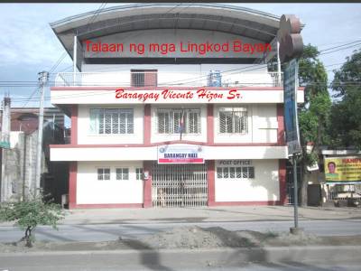
Barangay Vicente Hizon Sr. derived its name from the scions of a prominent, landed family considered to be one of the original settlers in the area.Barangay Vicente Hizon Sr. was created only on July 25, 2004 by virtue of a referendum that resulted in the division of Barangay Pampanga into three barangays, namely: Barangay Vicente Hizon Sr., Barangay Pampanga and Barangay Alfonso Anglingto Sr.It was officially created through City Council Resolution no. 02565-03 and City Council Ordinance no. 0161-03.
PHYSICAL CHARACTERISTICS
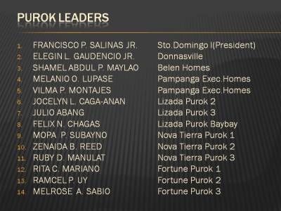
Barangay Vicente Hizon Sr. is strategically located in the 2nd Congressional District of Davao City. It is bounded on the North by the Davao International Airport runway, Barangay Alfonso Angliongto Sr. and Barangay Lapu-lapu in the West, coastline of the Davao Gulf in the South, J.P. Laurel Avenue (Davao-Agusan National Highway) and Insular Creek in the Southeast, Dona Asuncion in the East, Dona Asuncion Subdivision, Insular Village I, West Insular Village, Fortune Executive Homes, Nova Tierra Village 1-3, Pampanga Executive Homes Subdivision, Belen Homes, Sto. Domingo I, Donnasville, Model Homes, Lizada Village 2-3 in the Northeast. It is about seven kilometers away from the City Hall of Davao, and is accessible by all means of land transportation
Population
As of 2009 actual population count, Barangay Vicente Hizon Sr. is inhabited by 13, 598 locals, who are highly conversant in Filipino, English and native dialects. Population growth rate is 2%. Based on the 2009 social census mapping.
Topography, Slope and Elevation
In terms of landscape, the coastal zones can be described as almost even with a slope that ranges from 0%-3% percent. Of the total 212 hectares land area of the barangay is fringed with flat (>100 m) land elevation description.

